
Doyle Drive HALS Documentation
Location: San Francisco
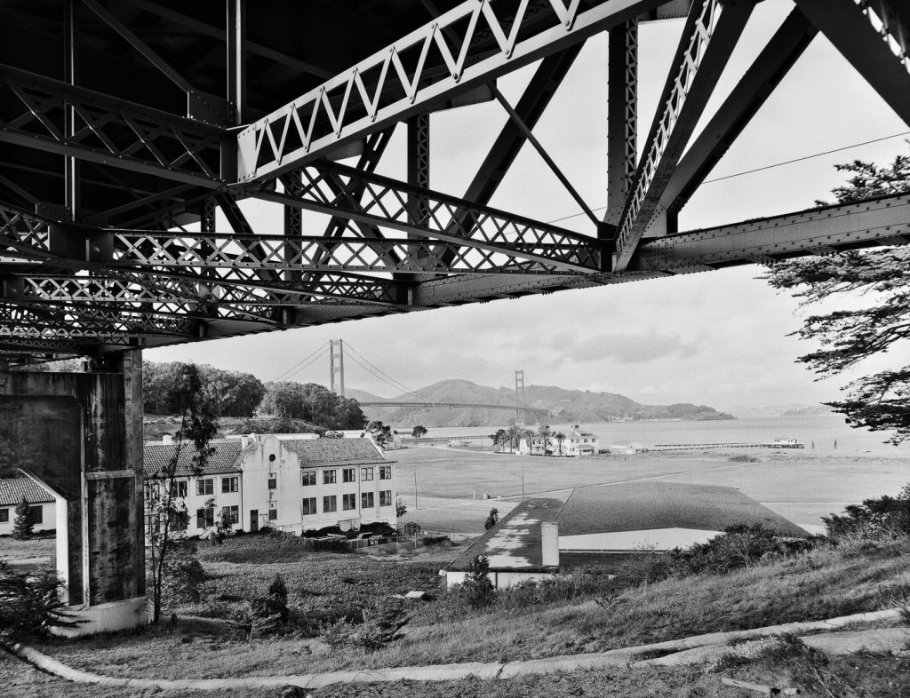
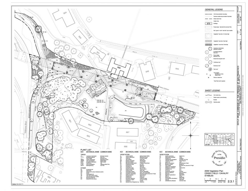
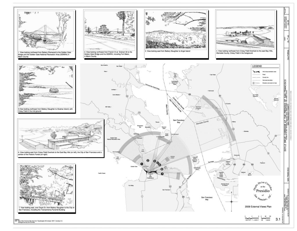
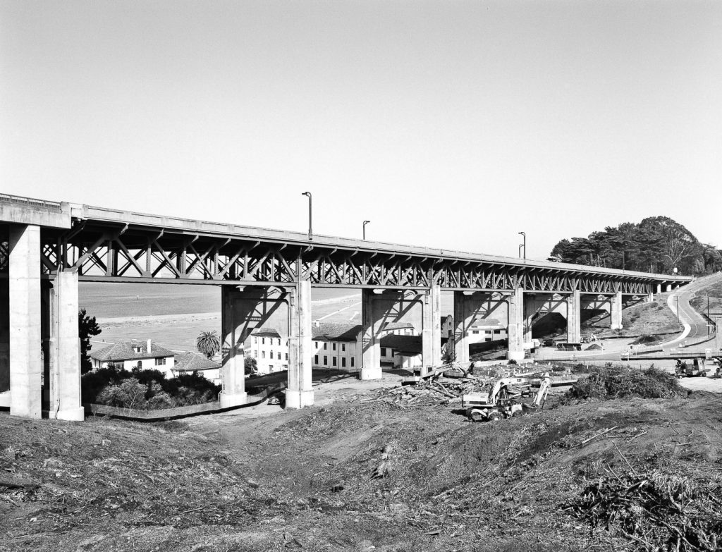
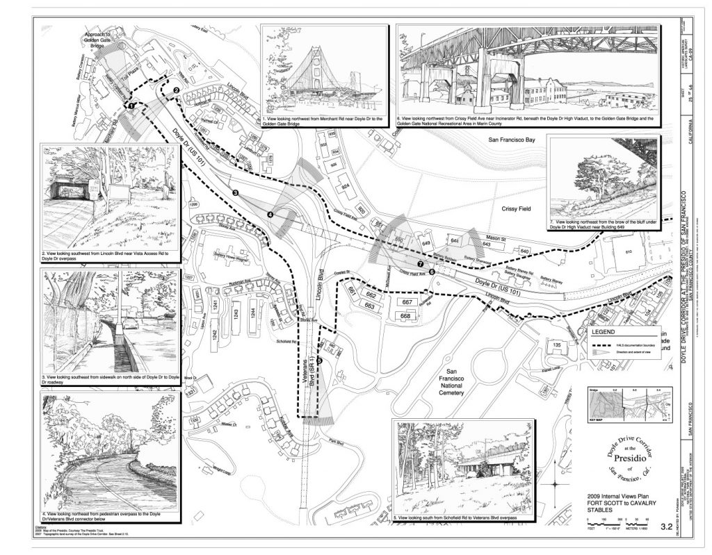
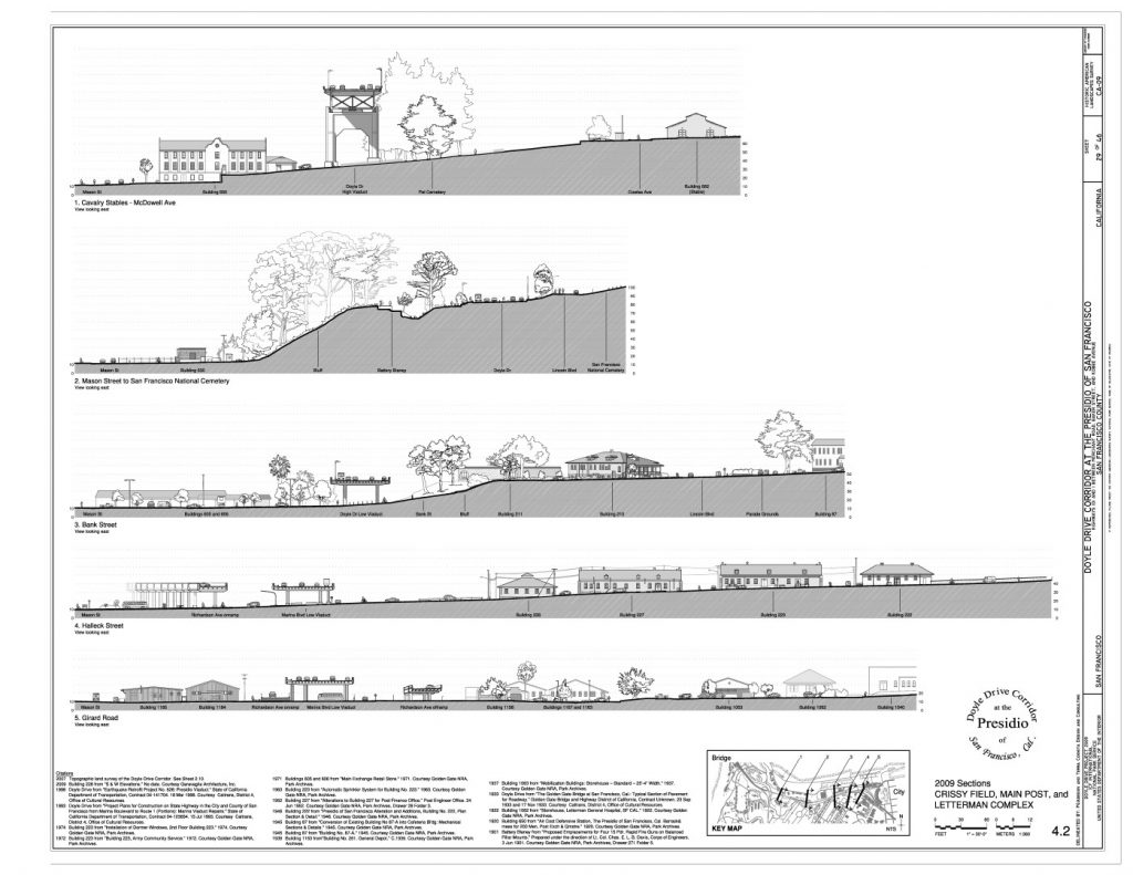
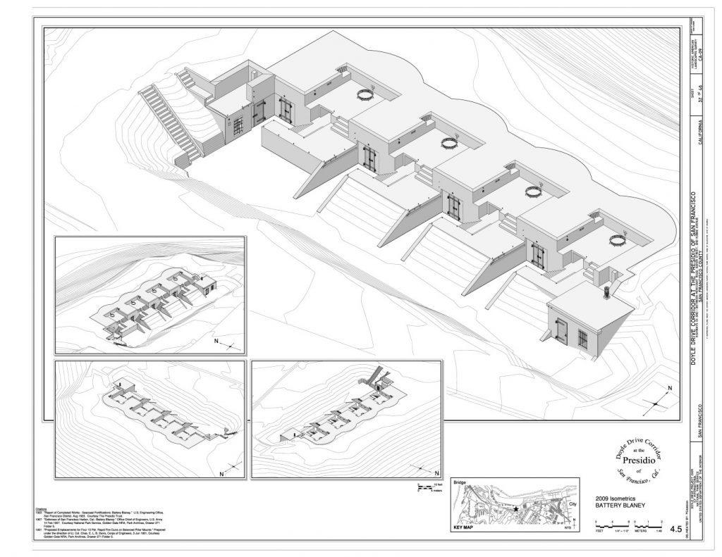
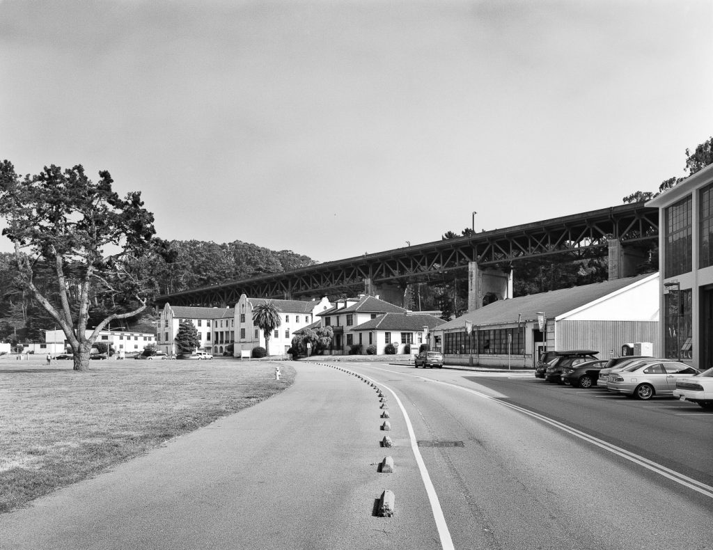
In collaboration with a team of historians, PGAdesign prepared measured drawings for the cultural landscape associated with Doyle Drive for HALS/HABS and HAER recordation. The Doyle Drive Project, located within San Francisco’s Presidio, was undertaken to remove the seismically unsafe Golden Gate Bridge approach and restore the landscape. The complex site, over a mile long, interfaced with an overhead roadway, at-grade roadways, and a network of landscape trails and spaces.
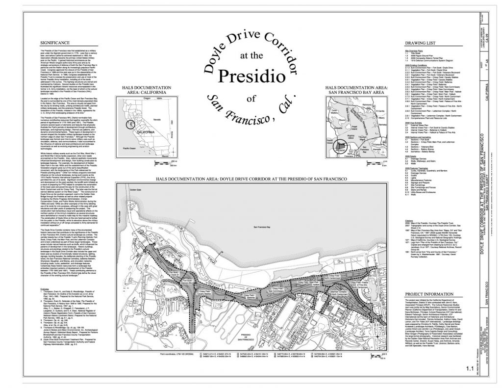
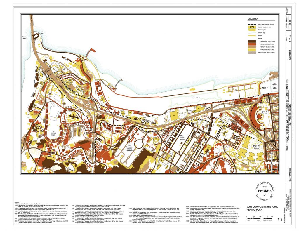
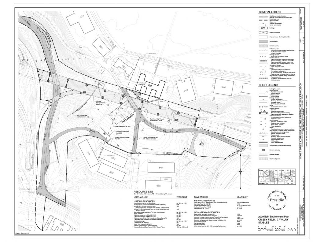
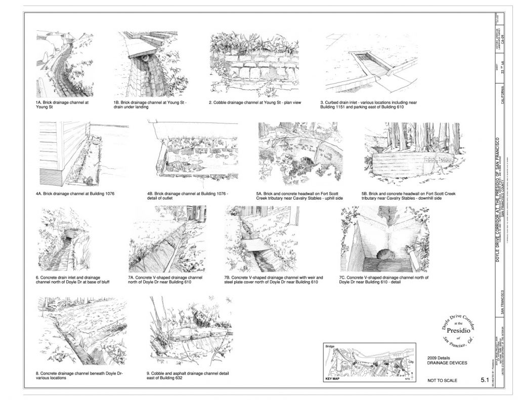
PGAdesign’s measured drawings complied with the requirements of the new Historic American Landscape Survey (HALS). At the project’s start, no similar documentation existed for such a unique site, and there was no clear methodology to follow. PGAdesign developed techniques for each site component, as well as a graphic technique to accomplish the work, testing and refining the approach throughout the process. The objective was to present the information in a manner easily understood and legible. The measured drawing set included plans produced in AutoCAD, sections, view diagrams, a figure-ground plan, hand-drawn details, a period plan, and typology sheets depicting features within the historic landscape.
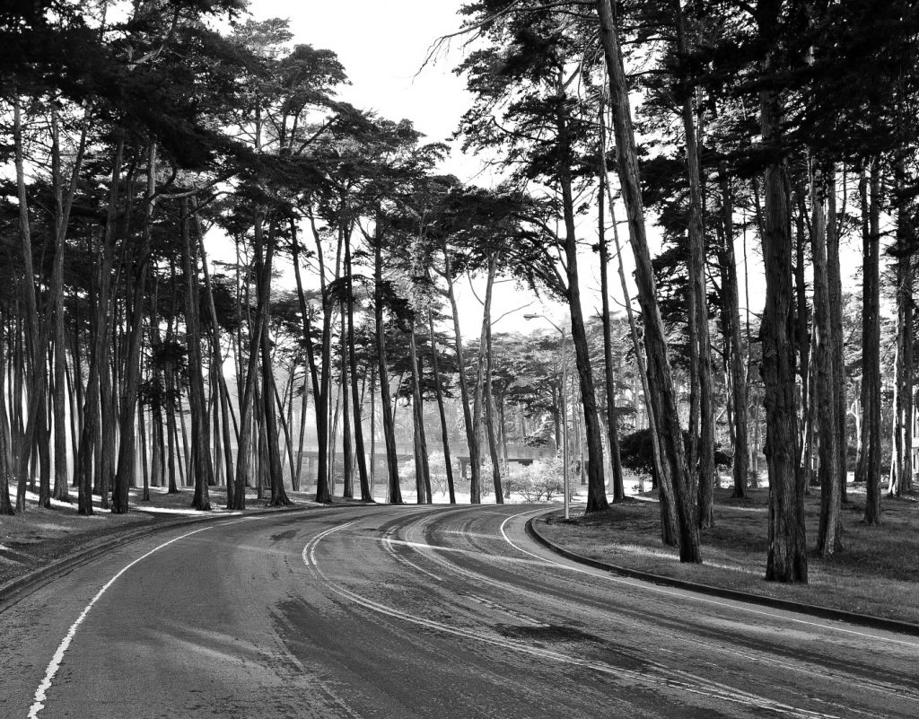
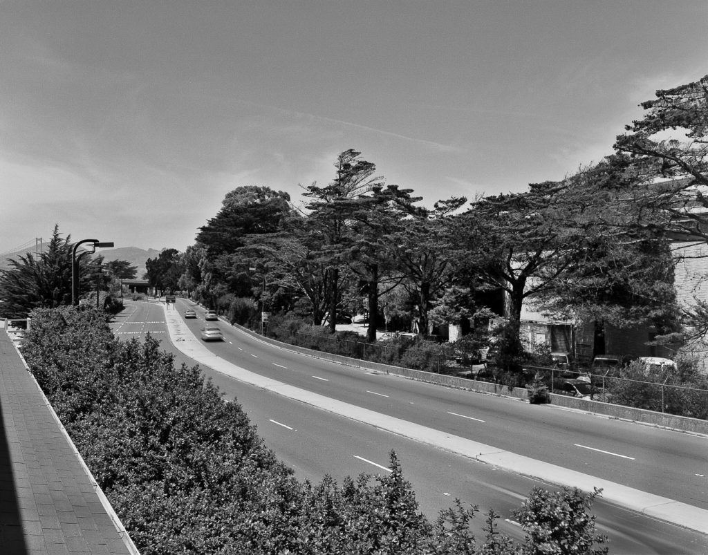
PGAdesign’s work in preserving the landscape history has helped shape present-day design plans. New pedestrian trails from Crissy Field to the bridge feature interpretive exhibits highlighting the battery views, which are derived from the HALS documentation.
Awards
2016 California Preservation Foundation Award for Cultural Resources Studies and Reports
2016 American Society of Landscape Architects NCC Merit Award

Edward Yarbrough, Senior Architectural Historian ICF International

Location: San Francisco
Project Type:
Historic
In collaboration with a team of historians, PGAdesign prepared measured drawings for the cultural landscape associated with Doyle Drive for HALS/HABS and HAER recordation. The Doyle Drive Project, located within San Francisco’s Presidio, was undertaken to remove the seismically unsafe Golden Gate Bridge approach and restore the landscape. The complex site, over a mile long, interfaced with an overhead roadway, at-grade roadways, and a network of landscape trails and spaces.
PGAdesign’s measured drawings complied with the requirements of the new Historic American Landscape Survey (HALS). At the project’s start, no similar documentation existed for such a unique site, and there was no clear methodology to follow. PGAdesign developed techniques for each site component, as well as a graphic technique to accomplish the work, testing and refining the approach throughout the process. The objective was to present the information in a manner easily understood and legible. The measured drawing set included plans produced in AutoCAD, sections, view diagrams, a figure-ground plan, hand-drawn details, a period plan, and typology sheets depicting features within the historic landscape.
PGAdesign’s work in preserving the landscape history has helped shape present-day design plans. New pedestrian trails from Crissy Field to the bridge feature interpretive exhibits highlighting the battery views, which are derived from the HALS documentation.
Awards
2016 California Preservation Foundation Award for Cultural Resources Studies and Reports
2016 American Society of Landscape Architects NCC Merit Award
Edward Yarbrough, Senior Architectural Historian ICF International
